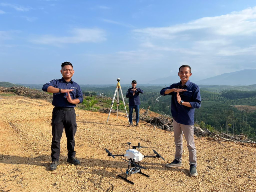
The agriculture sector is undergoing a technological revolution, with drones playing a pivotal role in modern farming. Drone mapping provides invaluable high-resolution imagery and multi-spectral data, yet managing this data can be overwhelming. Effective strategies are crucial to prevent information overload and derive actionable insights. However, agribusinesses face numerous challenges when establishing internal drone teams, from high initial investments to ongoing maintenance. This article explores how professional drone mapping services offer cost-effective and efficient solutions to these challenges.
The Data Management Challenge
Modern drone technologies generate vast amounts of data that require sophisticated management. High-resolution images and multi-spectral data offer detailed insights, but effectively navigating this data demands robust data management strategies. Without these strategies, agribusinesses risk encountering information overload, where valuable insights become obscured within the sheer volume of data.
The Cost Challenge of In-House UAV Mapping Teams
High Upfront Investments
Establishing an internal drone team involves substantial upfront costs, including purchasing drones, sensors, and software and training personnel to operate and maintain this equipment. Skilled drone pilots are crucial for safe operations, but developing high proficiency among internal staff demands considerable time and resources.
Ongoing Operational Costs
Regular maintenance, software updates, and potential upgrades add to operational costs. Equipment failures or downtime can disrupt critical data collection and analysis, impacting productivity and efficiency.

Expert Solutions for Efficient Data Management
Cloud-Based Storage and Processing
Professional aerial mapping services provide robust solutions for data management challenges. Utilizing cloud-based storage and processing ensures scalable, secure, and accessible platforms for managing large data volumes. This approach prevents overburdening local systems and assures data availability where and when needed.
Automated Data Analysis
Another significant advantage is automated data analysis. Service providers deploy AI and machine learning algorithms to swiftly analyze high-resolution imagery and multi-spectral data. This automation reduces reliance on human analysts and speeds up the generation of actionable insights, facilitating quicker decision-making processes.
Data Integration Services
Service providers seamlessly integrate drone-collected data with existing farm management systems. This integration makes data readily accessible and actionable within the agribusiness workflow, enhancing overall operational efficiency.
Cost-Effective Solutions for Agribusinesses
Subscription-Based Models
Financial constraints often deter agribusinesses from adopting advanced drone technologies. Drone mapping service providers offer flexible subscription plans that allow businesses to pay for services as needed, avoiding significant upfront investments. This model aids in better cost management and resource allocation.
Shared Resources and On-Demand Services
Providers also offer shared resources, reducing financial burdens on individual agribusinesses. Sharing high-end equipment, maintenance, and upgrades among multiple clients lowers costs, making advanced drone technology more accessible.
On-demand services eliminate the need for full-time internal drone teams, reducing costs. Agribusinesses can access services as required, ensuring cost-efficiency and flexibility without the ongoing expenses of maintaining and staffing an internal team.
Leveraging Expertise and Training
Professional Drone Pilots
Certified and experienced drone pilots ensure safe and efficient operations. Professional service providers offer expertise in the latest technologies and best practices, guaranteeing high-quality data collection and analysis.
Continuous Training Programs
Ongoing training programs and workshops keep agribusiness staff updated on the latest drone technologies and data analysis techniques. This training enhances internal capabilities without imposing training costs, ensuring staff can effectively utilize drone data.
In addition to training, expert consultation and technical support are vital aspects of the services offered. Agribusinesses receive guidance on optimizing drone data utilization, interpreting results, and making informed decisions based on gathered insights. This support ensures businesses fully leverage technology to enhance operations and productivity.
Terra Agri Mapping Business excels in providing these services, offering personalized consultation to help agribusinesses maximize drone mapping benefits. Our experienced professionals assist in understanding complex data, enabling informed decisions to enhance agricultural practices. With comprehensive support, your agribusiness can achieve greater efficiency and success in a competitive market.
Ensuring Maintenance and Reliability
Regular Maintenance and Upgrades
Timely maintenance and upgrades are essential for optimal drone performance. Professional service providers manage these tasks, reducing equipment failure risks and downtime. This proactive approach minimizes disruptions to data collection and operations.
Backup Systems and Proactive Monitoring
Implementing backup systems ensures operational continuity during technical issues or failures. Agriculture mapping drone services will prepare backup drones and equipment to minimize disruptions, ensuring smooth data collection even during challenges. Real-time monitoring tracks drone health and performance, facilitating prompt issue detection and resolution for peak operational efficiency and reliability.
Harnessing Advanced Technology and Innovation
Cutting-Edge Equipment and Custom Solutions
Professional drone mapping services offer access to advanced technology and ongoing innovation. Agriculture mapping drone services companies invest in the latest drone technologies, sensors, and software to provide high-quality geospatial data collection and analysis. This investment ensures that agribusinesses benefit from advanced capabilities without significant capital expenditures.
Customized solutions meet agribusiness needs, including tailored flight plans, data collection methods, and reporting formats. This customization ensures clients receive relevant and valuable insights from drone data.
Continuous Innovation
Professional drone mapping services maintain their edge through continuous innovation, staying ahead in technological advancements by integrating new tools and techniques to enhance service effectiveness. This commitment ensures that agribusinesses access the latest technologies, enabling them to remain competitive in a rapidly evolving industry.
Final Thought
Agricultural drone mapping service providers offer comprehensive solutions to challenges faced by agribusinesses. By harnessing advanced technology, employing cost-effective models, and providing expert support, these services streamline data management, lower costs, and ensure operational continuity. It allows agribusinesses to concentrate on core activities while taking advantage of the latest advancements in drone technology. Embracing these solutions enhances productivity and sustainability, positioning agribusinesses for success in a data-driven industry.

